Recorded Presentation
For more information on the Brevoort Park South Project, including a description of the draft concept design options, please watch this recorded presentation.
What changes are planned for Brevoort Park?
Underground storm water storage and other infrastructure improvements will be constructed in Brevoort Park South to reduce flood risk in an area with a history of significant flooding and expected future flooding with climate change.
The following images were captured during a major storm event in June 2022, and demonstrate the significant flood risk in the area.
.jpg)
.jpg)
.jpg)
.jpg)
.jpg)
Why is there such a high risk of flooding in this area?
Flooding only occurs during significant rain events. Neighbourhoods developed prior to 1989 were not constructed to the same standards and storage we install today. Significant rain events are now managed through wet and dry ponds, and have the ability to collect high volumes of storm water.
How does underground storm water storage work?
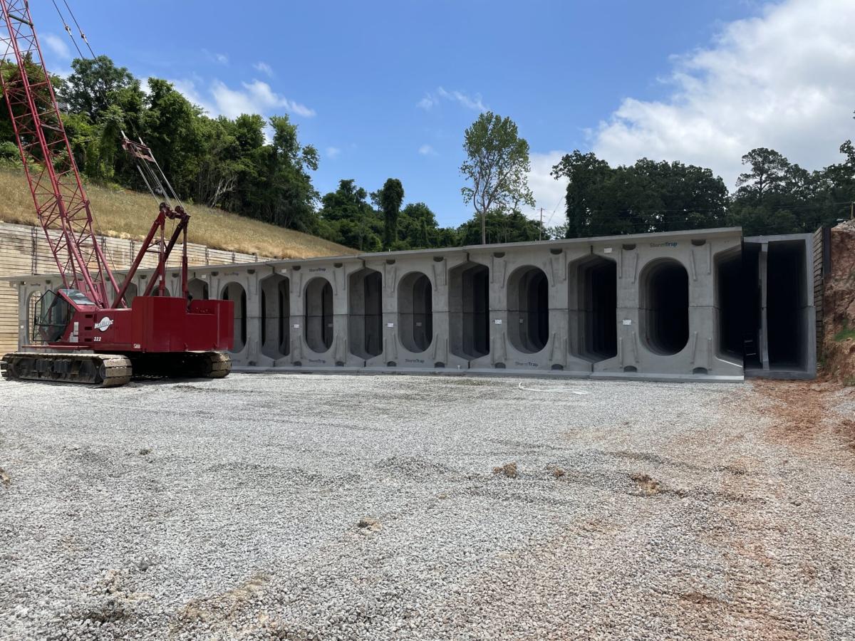
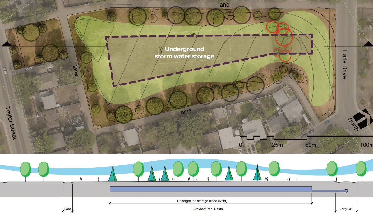
Due to the shape and size of Brevoort Park South, as well as other considerations, underground storm water storage will be utilized instead of installing a dry pond as was done with previous Flood Control Strategy projects. The park will be excavated to allow for the storage tanks to be installed, then we will backfill overtop of the tanks and restore the park to existing conditions.
The underground storage tanks will act as a buried dry pond. The new storm sewer infrastructure connected to the intersection of Early Drive and Tucker Crescent will transport storm water to the underground storage to reduce flooding during intense rainfall events. Storm water will be stored in the underground storage tanks until the existing storm sewer has capacity and then drain through the existing storm sewer network.

How will this project impact the risk of flooding in the area?
The underground storage tanks will provide approximately 9,000 m3 of storage, reducing flooding around the intersection of Early Drive and Tucker Crescent. Instead of storm water ponding on the street and possibly entering nearby basements, the storm water will be transported to the underground storage tanks to mitigate flooding for the area.
The map below displays flood risk in the area under current conditions in the event of a 1 in 10-year storm, followed by a map displaying the flood risk during a 1 in 10-year storm once the underground storage and additional storm water infrastructure is in place.


How will Brevoort Park be impacted?
Brevoort Park South
New storm water sewer infrastructure will be installed on Early Drive connecting the intersection of Early Drive and Tucker Crescent to the north end of Brevoort Park South. The new storm water sewer piping will be connected to the underground storage tanks to be installed in Brevoort Park South. The park will be excavated to allow for the underground storage tanks to be installed, which will start in approximately February 2024.
Once the tanks and storm sewer infrastructure are installed, the park will be restored to existing conditions. To give the restored park space time to establish, the park will not be available for public use until October 2025.
Brevoort Park North
No construction is planned for Brevoort Park North.
When will construction occur?
- Excavation of Brevoort Park South: February 2024
- Storm sewer infrastructure and storage tanks: May to November 2024
- Park establishment: November 2024 to October 2025
What areas will be impacted by construction?
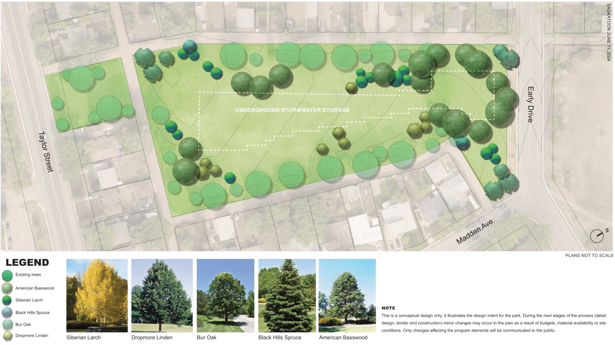
Below is a map displaying the construction areas.

Will the park be available for use during construction?
Brevoort Park South will not be available for use during construction. Construction fence will be installed around the work area.
Will trees be impacted by the project?
Approximately 6 trees are planned to be removed to allow for the installation of the underground storage tanks. Efforts will be made to preserve as many trees as possible during the detailed design and construction of the project. If tree removal is required, appropriate stakeholders will be informed, and the project will provide necessary compensation as outlined in City Council Policy C09-011 Trees on City Property.
What is the Flood Control Strategy?
If you've ever experienced flood damage, you know how devastating it can be. Though parts of Saskatoon have always been susceptible to flooding, and flood protection measures to date have helped, climate change is expected to bring more frequent and intense storms.
In December 2018, City Council approved implementation of the nine-year $54 million Flood Control Strategy to mitigate flooding in ten areas that experience frequent flooding. Brevoort Park is the fourth area receiving upgrades as part of this Strategy.
Visit the Flood Control Strategy page for more information.
How is the project being funded?
In 2019, the Government of Canada (Government) approved 40% cost sharing of the Flood Control Strategy's total estimated eligible expenses of $54.1 million, up to a maximum of $21.6 million through the Disaster Mitigation and Adaptation Fund. The City approved Storm Water Utility funding of $32.4 million through previously approved increases to the Storm Water Management Charge to cover the other 60% of the expenses.
The Brevoort Park South project is estimated to cost $10.3 million with the City contributing 60% ($6.2 million) and the Government of Canada through the Disaster Mitigation and Adaptation Fund is contributing 40% ($4.1 million).

.jpg)
.jpg)
.jpg)
.jpg)
.jpg)


